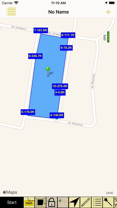
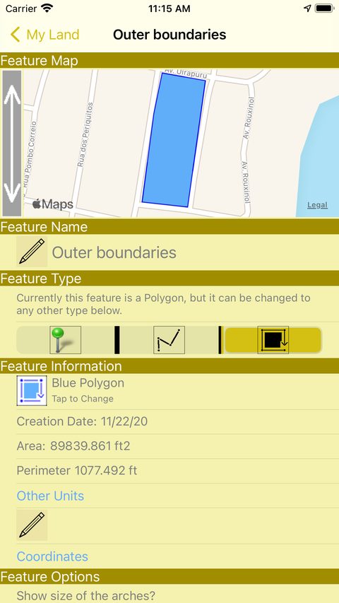
Walk the edge of your land and iMapIt uses the GPS of your iPhone or iPad to calculate area and perimeter on the spot. Then take the map to AutoCAD, Google Earth or a spreadsheet.
For iPhone and iPad · iOS 11 or later · Portuguese, English and French
Choose what you want to record, start walking and let the app do the math.
Mark your favorite spot, the tree you want to find again, the starting point of a run or the rare bird you saw today.
Record the trail you walked, the access road or the fence you are about to build. Length comes out in metric and imperial units.
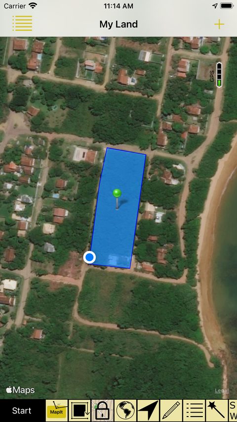
Outline a plot you want to buy, the map of your land, the new house or the spot for a future pool. Area and perimeter show up ready.
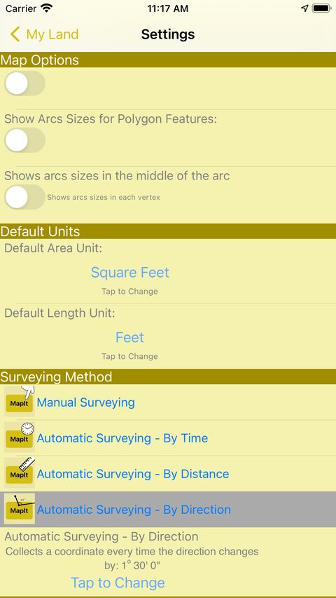
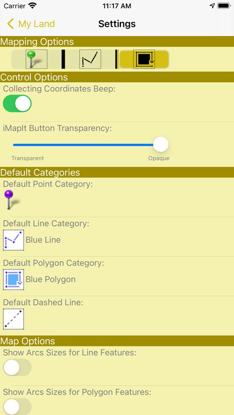
Areas in square meters, imperial measures and even Thai units (Rai, Ngan and Tarang Wah). iMapIt picks the unit from your location, and you can change it whenever you like.
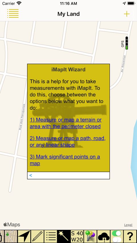
iMapIt has a built-in assistant, the Wizard, that helps beginners take their first measurements. You say what you want to do and it guides you through the options.

Press a button whenever you want or walk hands-free. Automatic collection keeps working even with the screen off or locked.
Stand in place and tap the MapIt button. One coordinate per tap, with full control over every point.
One coordinate every interval of seconds you set. Great for trails and long routes.
One coordinate every 5 meters, 10 meters or whatever distance you prefer. Regular lines, effortlessly.
One coordinate at every turn. Few points on straights, more precision at corners.
The map can rotate as you move, so you always see what is ahead. Switch between a drawn map and satellite photos with one tap.

Editing tools to get each measurement just the way you need it. The functions create a new feature and keep the original, so you never lose anything.
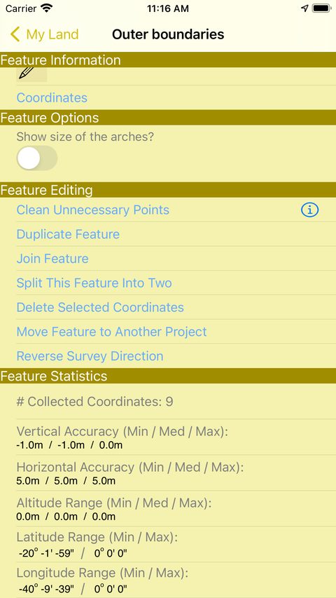
Automatically removes unnecessary points and keeps the same outline. Lighter files that are faster to send.
Join two or more features into one, or split one into two.
Duplicate a feature or move it to another project, handy to export just part of the survey.
Each measurement also shows detailed statistics: number of coordinates collected, horizontal and vertical accuracy, altitude range, latitude and longitude. You can change a feature's type on the spot: a point becomes a line, a line becomes an area.

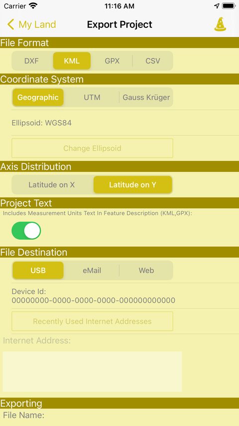
Measuring is half the job. The other half is using the survey. iMapIt exports to the formats that surveyors, engineers and curious minds already use.
DXF for drawing programs like AutoCAD, KML for Google Earth and Google Maps, GPX for GPS apps and CSV for Excel and spreadsheets in general.

Lite is free and lets you try collecting the iMapIt way. Pro unlocks everything, with no limits.
| What you do | Pro | Lite |
|---|---|---|
| Collect points, lines and polygons | ✓ | ✓ |
| Manual and automatic collection (time, distance, direction) | ✓ | ✓ |
| Schematic map, satellite and rotating map | ✓ | ✓ |
| Multiple projects, pins, colors and categories | ✓ | ✓ |
| Measure lengths and areas without limit | ✓ | once |
| Metric, imperial and Thai units | ✓ | once |
| Export to DXF, KML, GPX and CSV | ✓ | — |
| UTM and Gauss Krüger projections | ✓ | — |
| Send by USB, email or web server | ✓ | — |
Pro and Lite are separate apps and measurements do not migrate from one to the other.


Download iMapIt, take a walk and watch the area appear on screen.
Download iMapItFamily Sharing: up to six family members can use it.